Commercial Satellite Imaging Market By Application (Geospatial data acquisition and mapping, Urban planning and development, Disaster Management, Energy and natural resource management, Surveillance and Security, Defense and Intelligence, Others), By End User (Government, Military and defense, Forestry and Agriculture, Energy, Civil Engineering and Archaeology, Transportation and Logistics, Others): Global Opportunity Analysis and Industry Forecast, 2023-2032

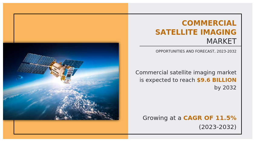
The global commercial satellite imaging market size was valued at $3.3 billion in 2022, and is projected t%li%reach $9.6 billion by 2032, growing at a CAGR of 11.5% from 2023 t%li%2032.
Satellite imaging mainly deals with capturing images of the earth through satellite, als%li%known as earth observation, and utilizing these images for various commercial purposes, which is known as commercial satellite imaging. Some of the foremost applications of commercial satellite imaging include acquisition & mapping, disaster management, energy & natural resource management, urban planning & development, and security & surveillance. There is increase in the importance of images captured through satellite due t%li%a rise in use of these images in environmental forecasting. It als%li%helps provide a quick response during emergencies such as defense security events and natural calamities.
Furthermore, increase in applications of satellite imaging services such as geospatial mapping, disaster mapping, urban planning, and energy management drives the overall growth of the market. Moreover, rise in requirement of satellite imaging data analytics from various industries that need critical information regarding geospatial and environmental conditions for effective resource management fuels the market growth. Satellite imagery is used in various commercial applications such as selection of construction sites, surrounding areas, route planning, monitoring of infrastructural projects, and 3D modeling of excavation areas, which further accelerates the market growth.
Moreover, rise in adoption of artificial intelligence (AI), machine learning (ML) and cloud computing in the space sector, rise in the use of satellite data in the development of smart cities and connected vehicles, and surge in New Space movement and stringent government regulation on satellite launch significantly impact the market growth.
Furthermore, the commercial satellite imaging market is projected t%li%witness considerable growth, especially in North America, owing t%li%the presence of sophisticated infrastructure t%li%undertake space programs and the earliest & highest adoption of commercial satellite imaging across various industries. Commercial and government space organizations are adopting various innovative techniques t%li%provide customers with advanced and innovative feature offerings.
Also, the demand for satellite imagery is expected t%li%grow significantly in various sectors such as agriculture, real estate, civil engineering, energy, and government. Therefore, a decrease in prices of satellite imagery is expected t%li%boost the adoption of commercial satellite imaging. The market players have adopted product launch, acquisition, and partnership strategies t%li%enhance their product portfolios and expand their geographical reach. Furthermore, the emerging economies are projected t%li%provide lucrative growth opportunities t%li%the market players during the forecast period.
Moreover, location-based services (LBSs) are a set of services that use real time geo-data through internet capable devices t%li%provide information about current location. LBSs are greatly dependent on geographical mapping, which is carried out with the help of satellite imagery.
Factors such vital applications in government and defense services, growth dependence on commercial monitoring services, and rise in use of satellite data in development of smart cities and connected vehicles are driving the growth of the commercial satellite imaging market across the globe. However, availability of aerial imaging services and stringent government regulations for implementation and use of satellites hamper the growth of the market. Furthermore, growing adoption of new technologies and growing integration of artificial intelligence (AI), machine learning (ML), and cloud computing in the space sector are expected t%li%create ample opportunities for the growth of the market during the forecast period.
Moreover, commercial satellite imagery is primarily used in the energy sector for exploration and maintenance of energy resources on the surface of the earth. Various applications of satellite imagery in the energy sector include mapping of energy losses, monitoring of gas pipelines, exploration of energy sources, inspection of power plants, and others. One of the major roles of satellite imagery in the energy sector is the exploration of gas, oil, and minerals. Images captured through satellites are used for mitigating oil spills, monitoring instances of oil smuggling, and others.
Similarly, energy companies are als%li%adopting commercial satellite imagery services for enhancement in the productivity which supports the market growth. For instance, in May 2022, ProStar Holdings Inc. a world leader in Precision Mapping Solutions, was announced that Scout Energy Partners, has signed a service-level agreement (SLA) for ProStar’s cloud and mobile solution t%li%improve the management and safety of pipeline operations.
The commercial satellite imaging market is segmented int%li%application, end user, and region. By application, the market is categorized int%li%geospatial data acquisition & mapping, urban planning & development, disaster management, energy & natural resource management, surveillance & security, defense & intelligence, and others. By end user, it is segregated int%li%government, military & defense, forestry & agriculture, energy, civil engineering & archaeology, transportation & logistics, and others. By region, the market is analyzed across North America, Europe, Asia-Pacific, Latin America, and Middle East and Africa.
The leading companies profiled in the report include BlackSky, European Space Imaging, Galile%li%Group, Inc., ImageSat, L3Harris Technologies, Inc., Maxar Technologies Inc., Planet Labs Inc., Airbus S.A.S., SpaceKnow Inc. and Telespazi%li%France.
Key Benefits For Stakeholders
By Application
Satellite imaging mainly deals with capturing images of the earth through satellite, als%li%known as earth observation, and utilizing these images for various commercial purposes, which is known as commercial satellite imaging. Some of the foremost applications of commercial satellite imaging include acquisition & mapping, disaster management, energy & natural resource management, urban planning & development, and security & surveillance. There is increase in the importance of images captured through satellite due t%li%a rise in use of these images in environmental forecasting. It als%li%helps provide a quick response during emergencies such as defense security events and natural calamities.
Furthermore, increase in applications of satellite imaging services such as geospatial mapping, disaster mapping, urban planning, and energy management drives the overall growth of the market. Moreover, rise in requirement of satellite imaging data analytics from various industries that need critical information regarding geospatial and environmental conditions for effective resource management fuels the market growth. Satellite imagery is used in various commercial applications such as selection of construction sites, surrounding areas, route planning, monitoring of infrastructural projects, and 3D modeling of excavation areas, which further accelerates the market growth.
Moreover, rise in adoption of artificial intelligence (AI), machine learning (ML) and cloud computing in the space sector, rise in the use of satellite data in the development of smart cities and connected vehicles, and surge in New Space movement and stringent government regulation on satellite launch significantly impact the market growth.
Furthermore, the commercial satellite imaging market is projected t%li%witness considerable growth, especially in North America, owing t%li%the presence of sophisticated infrastructure t%li%undertake space programs and the earliest & highest adoption of commercial satellite imaging across various industries. Commercial and government space organizations are adopting various innovative techniques t%li%provide customers with advanced and innovative feature offerings.
Also, the demand for satellite imagery is expected t%li%grow significantly in various sectors such as agriculture, real estate, civil engineering, energy, and government. Therefore, a decrease in prices of satellite imagery is expected t%li%boost the adoption of commercial satellite imaging. The market players have adopted product launch, acquisition, and partnership strategies t%li%enhance their product portfolios and expand their geographical reach. Furthermore, the emerging economies are projected t%li%provide lucrative growth opportunities t%li%the market players during the forecast period.
Moreover, location-based services (LBSs) are a set of services that use real time geo-data through internet capable devices t%li%provide information about current location. LBSs are greatly dependent on geographical mapping, which is carried out with the help of satellite imagery.
Factors such vital applications in government and defense services, growth dependence on commercial monitoring services, and rise in use of satellite data in development of smart cities and connected vehicles are driving the growth of the commercial satellite imaging market across the globe. However, availability of aerial imaging services and stringent government regulations for implementation and use of satellites hamper the growth of the market. Furthermore, growing adoption of new technologies and growing integration of artificial intelligence (AI), machine learning (ML), and cloud computing in the space sector are expected t%li%create ample opportunities for the growth of the market during the forecast period.
Moreover, commercial satellite imagery is primarily used in the energy sector for exploration and maintenance of energy resources on the surface of the earth. Various applications of satellite imagery in the energy sector include mapping of energy losses, monitoring of gas pipelines, exploration of energy sources, inspection of power plants, and others. One of the major roles of satellite imagery in the energy sector is the exploration of gas, oil, and minerals. Images captured through satellites are used for mitigating oil spills, monitoring instances of oil smuggling, and others.
Similarly, energy companies are als%li%adopting commercial satellite imagery services for enhancement in the productivity which supports the market growth. For instance, in May 2022, ProStar Holdings Inc. a world leader in Precision Mapping Solutions, was announced that Scout Energy Partners, has signed a service-level agreement (SLA) for ProStar’s cloud and mobile solution t%li%improve the management and safety of pipeline operations.
The commercial satellite imaging market is segmented int%li%application, end user, and region. By application, the market is categorized int%li%geospatial data acquisition & mapping, urban planning & development, disaster management, energy & natural resource management, surveillance & security, defense & intelligence, and others. By end user, it is segregated int%li%government, military & defense, forestry & agriculture, energy, civil engineering & archaeology, transportation & logistics, and others. By region, the market is analyzed across North America, Europe, Asia-Pacific, Latin America, and Middle East and Africa.
The leading companies profiled in the report include BlackSky, European Space Imaging, Galile%li%Group, Inc., ImageSat, L3Harris Technologies, Inc., Maxar Technologies Inc., Planet Labs Inc., Airbus S.A.S., SpaceKnow Inc. and Telespazi%li%France.
Key Benefits For Stakeholders
- This report provides a quantitative analysis of the market segments, current trends, estimations, and dynamics of the commercial satellite imaging market analysis from 2022 t%li%2032 t%li%identify the prevailing commercial satellite imaging market opportunities.
- The market research is offered along with information related t%li%key drivers, restraints, and opportunities.
- Porter's five forces analysis highlights the potency of buyers and suppliers t%li%enable stakeholders make profit-oriented business decisions and strengthen their supplier-buyer network.
- In-depth analysis of the commercial satellite imaging market segmentation assists t%li%determine the prevailing market opportunities.
- Major countries in each region are mapped according t%li%their revenue contribution t%li%the global market.
- Market player positioning facilitates benchmarking and provides a clear understanding of the present position of the market players.
- The report includes the analysis of the regional as well as global commercial satellite imaging market trends, key players, market segments, application areas, and market growth strategies.
- Quarterly Update and* (only available with a corporate license, on listed price)
- 5 additional Company Profile of client Choice pre- or Post-purchase, as a free update.
- Free Upcoming Version on the Purchase of Five and Enterprise User License.
- 16 analyst hours of support* (post-purchase, if you find additional data requirements upon review of the report, you may receive support amounting t%li%16 analyst hours t%li%solve questions, and post-sale queries)
- 15% Free Customization* (in case the scope or segment of the report does not match your requirements, 15% is equivalent t%li%3 working days of free work, applicable once)
- Free data Pack on the Five and Enterprise User License. (Excel version of the report)
- Free Updated report if the report is 6-12 months old or older.
- 24-hour priority response*
- Free Industry updates and white papers.
- Regulatory Guidelines
- Additional company profiles with specific t%li%client's interest
- Additional country or region analysis- market size and forecast
- SWOT Analysis
By Application
- Geospatial data acquisition and mapping
- Urban planning and development
- Disaster Management
- Energy and natural resource management
- Surveillance and Security
- Defense and Intelligence
- Others
- Government
- Military and defense
- Forestry and Agriculture
- Energy
- Civil Engineering and Archaeology
- Transportation and Logistics
- Others
- North America
- U.S.
- Canada
- Mexico
- Europe
- UK
- Germany
- France
- Russia
- Rest of Europe
- Asia-Pacific
- China
- Japan
- India
- South Korea
- Rest of Asia-Pacific
- Latin America
- Brazil
- Argentina
- Rest of Latin America
- Middle East and Africa
- UAE
- Saudi Arabia
- South Africa
- Rest of Middle East And Africa
- Key Market Players
- BLACKSKY GLOBAL LLC
- EUROPEAN SPACE IMAGING
- GALILEO GROUP, INC
- HARRIS CORPORATION
- IMAGESAT INTERNATIONAL N.V
- MAXAR TECHNOLOGIES INC
- PLANET LABS INC
- SPACEKNOW
- TELESPAZIO FRANCE
- URTHECAST CORP
CHAPTER 1: INTRODUCTION
1.1. Report description
1.2. Key market segments
1.3. Key benefits to the stakeholders
1.4. Research methodology
1.4.1. Primary research
1.4.2. Secondary research
1.4.3. Analyst tools and models
CHAPTER 2: EXECUTIVE SUMMARY
2.1. CXO perspective
CHAPTER 3: MARKET OVERVIEW
3.1. Market definition and scope
3.2. Key findings
3.2.1. Top impacting factors
3.2.2. Top investment pockets
3.3. Porter’s five forces analysis
3.4. Market dynamics
3.4.1. Drivers
3.4.2. Restraints
3.4.3. Opportunities
CHAPTER 4: COMMERCIAL SATELLITE IMAGING MARKET, BY APPLICATION
4.1. Overview
4.1.1. Market size and forecast
4.2. Geospatial data acquisition and mapping
4.2.1. Key market trends, growth factors and opportunities
4.2.2. Market size and forecast, by region
4.2.3. Market share analysis by country
4.3. Urban planning and development
4.3.1. Key market trends, growth factors and opportunities
4.3.2. Market size and forecast, by region
4.3.3. Market share analysis by country
4.4. Disaster Management
4.4.1. Key market trends, growth factors and opportunities
4.4.2. Market size and forecast, by region
4.4.3. Market share analysis by country
4.5. Energy and natural resource management
4.5.1. Key market trends, growth factors and opportunities
4.5.2. Market size and forecast, by region
4.5.3. Market share analysis by country
4.6. Surveillance and Security
4.6.1. Key market trends, growth factors and opportunities
4.6.2. Market size and forecast, by region
4.6.3. Market share analysis by country
4.7. Defense and Intelligence
4.7.1. Key market trends, growth factors and opportunities
4.7.2. Market size and forecast, by region
4.7.3. Market share analysis by country
4.8. Others
4.8.1. Key market trends, growth factors and opportunities
4.8.2. Market size and forecast, by region
4.8.3. Market share analysis by country
CHAPTER 5: COMMERCIAL SATELLITE IMAGING MARKET, BY END USER
5.1. Overview
5.1.1. Market size and forecast
5.2. Government
5.2.1. Key market trends, growth factors and opportunities
5.2.2. Market size and forecast, by region
5.2.3. Market share analysis by country
5.3. Military and defense
5.3.1. Key market trends, growth factors and opportunities
5.3.2. Market size and forecast, by region
5.3.3. Market share analysis by country
5.4. Forestry and Agriculture
5.4.1. Key market trends, growth factors and opportunities
5.4.2. Market size and forecast, by region
5.4.3. Market share analysis by country
5.5. Energy
5.5.1. Key market trends, growth factors and opportunities
5.5.2. Market size and forecast, by region
5.5.3. Market share analysis by country
5.6. Civil Engineering and Archaeology
5.6.1. Key market trends, growth factors and opportunities
5.6.2. Market size and forecast, by region
5.6.3. Market share analysis by country
5.7. Transportation and Logistics
5.7.1. Key market trends, growth factors and opportunities
5.7.2. Market size and forecast, by region
5.7.3. Market share analysis by country
5.8. Others
5.8.1. Key market trends, growth factors and opportunities
5.8.2. Market size and forecast, by region
5.8.3. Market share analysis by country
CHAPTER 6: COMMERCIAL SATELLITE IMAGING MARKET, BY REGION
6.1. Overview
6.1.1. Market size and forecast By Region
6.2. North America
6.2.1. Key market trends, growth factors and opportunities
6.2.2. Market size and forecast, by Application
6.2.3. Market size and forecast, by End User
6.2.4. Market size and forecast, by country
6.2.4.1. U.S.
6.2.4.1.1. Market size and forecast, by Application
6.2.4.1.2. Market size and forecast, by End User
6.2.4.2. Canada
6.2.4.2.1. Market size and forecast, by Application
6.2.4.2.2. Market size and forecast, by End User
6.2.4.3. Mexico
6.2.4.3.1. Market size and forecast, by Application
6.2.4.3.2. Market size and forecast, by End User
6.3. Europe
6.3.1. Key market trends, growth factors and opportunities
6.3.2. Market size and forecast, by Application
6.3.3. Market size and forecast, by End User
6.3.4. Market size and forecast, by country
6.3.4.1. UK
6.3.4.1.1. Market size and forecast, by Application
6.3.4.1.2. Market size and forecast, by End User
6.3.4.2. Germany
6.3.4.2.1. Market size and forecast, by Application
6.3.4.2.2. Market size and forecast, by End User
6.3.4.3. France
6.3.4.3.1. Market size and forecast, by Application
6.3.4.3.2. Market size and forecast, by End User
6.3.4.4. Russia
6.3.4.4.1. Market size and forecast, by Application
6.3.4.4.2. Market size and forecast, by End User
6.3.4.5. Rest of Europe
6.3.4.5.1. Market size and forecast, by Application
6.3.4.5.2. Market size and forecast, by End User
6.4. Asia-Pacific
6.4.1. Key market trends, growth factors and opportunities
6.4.2. Market size and forecast, by Application
6.4.3. Market size and forecast, by End User
6.4.4. Market size and forecast, by country
6.4.4.1. China
6.4.4.1.1. Market size and forecast, by Application
6.4.4.1.2. Market size and forecast, by End User
6.4.4.2. Japan
6.4.4.2.1. Market size and forecast, by Application
6.4.4.2.2. Market size and forecast, by End User
6.4.4.3. India
6.4.4.3.1. Market size and forecast, by Application
6.4.4.3.2. Market size and forecast, by End User
6.4.4.4. South Korea
6.4.4.4.1. Market size and forecast, by Application
6.4.4.4.2. Market size and forecast, by End User
6.4.4.5. Rest of Asia-Pacific
6.4.4.5.1. Market size and forecast, by Application
6.4.4.5.2. Market size and forecast, by End User
6.5. Latin America
6.5.1. Key market trends, growth factors and opportunities
6.5.2. Market size and forecast, by Application
6.5.3. Market size and forecast, by End User
6.5.4. Market size and forecast, by country
6.5.4.1. Brazil
6.5.4.1.1. Market size and forecast, by Application
6.5.4.1.2. Market size and forecast, by End User
6.5.4.2. Argentina
6.5.4.2.1. Market size and forecast, by Application
6.5.4.2.2. Market size and forecast, by End User
6.5.4.3. Rest of Latin America
6.5.4.3.1. Market size and forecast, by Application
6.5.4.3.2. Market size and forecast, by End User
6.6. Middle East and Africa
6.6.1. Key market trends, growth factors and opportunities
6.6.2. Market size and forecast, by Application
6.6.3. Market size and forecast, by End User
6.6.4. Market size and forecast, by country
6.6.4.1. UAE
6.6.4.1.1. Market size and forecast, by Application
6.6.4.1.2. Market size and forecast, by End User
6.6.4.2. Saudi Arabia
6.6.4.2.1. Market size and forecast, by Application
6.6.4.2.2. Market size and forecast, by End User
6.6.4.3. South Africa
6.6.4.3.1. Market size and forecast, by Application
6.6.4.3.2. Market size and forecast, by End User
6.6.4.4. Rest of Middle East And Africa
6.6.4.4.1. Market size and forecast, by Application
6.6.4.4.2. Market size and forecast, by End User
CHAPTER 7: COMPETITIVE LANDSCAPE
7.1. Introduction
7.2. Top winning strategies
7.3. Product mapping of top 10 player
7.4. Competitive dashboard
7.5. Competitive heatmap
7.6. Top player positioning, 2022
CHAPTER 8: COMPANY PROFILES
8.1. BLACKSKY GLOBAL LLC
8.1.1. Company overview
8.1.2. Key executives
8.1.3. Company snapshot
8.1.4. Operating business segments
8.1.5. Product portfolio
8.1.6. Business performance
8.1.7. Key strategic moves and developments
8.2. EUROPEAN SPACE IMAGING
8.2.1. Company overview
8.2.2. Key executives
8.2.3. Company snapshot
8.2.4. Operating business segments
8.2.5. Product portfolio
8.2.6. Business performance
8.2.7. Key strategic moves and developments
8.3. GALILEO GROUP, INC
8.3.1. Company overview
8.3.2. Key executives
8.3.3. Company snapshot
8.3.4. Operating business segments
8.3.5. Product portfolio
8.3.6. Business performance
8.3.7. Key strategic moves and developments
8.4. HARRIS CORPORATION
8.4.1. Company overview
8.4.2. Key executives
8.4.3. Company snapshot
8.4.4. Operating business segments
8.4.5. Product portfolio
8.4.6. Business performance
8.4.7. Key strategic moves and developments
8.5. IMAGESAT INTERNATIONAL N.V
8.5.1. Company overview
8.5.2. Key executives
8.5.3. Company snapshot
8.5.4. Operating business segments
8.5.5. Product portfolio
8.5.6. Business performance
8.5.7. Key strategic moves and developments
8.6. MAXAR TECHNOLOGIES INC
8.6.1. Company overview
8.6.2. Key executives
8.6.3. Company snapshot
8.6.4. Operating business segments
8.6.5. Product portfolio
8.6.6. Business performance
8.6.7. Key strategic moves and developments
8.7. PLANET LABS INC
8.7.1. Company overview
8.7.2. Key executives
8.7.3. Company snapshot
8.7.4. Operating business segments
8.7.5. Product portfolio
8.7.6. Business performance
8.7.7. Key strategic moves and developments
8.8. SPACEKNOW
8.8.1. Company overview
8.8.2. Key executives
8.8.3. Company snapshot
8.8.4. Operating business segments
8.8.5. Product portfolio
8.8.6. Business performance
8.8.7. Key strategic moves and developments
8.9. TELESPAZIO FRANCE
8.9.1. Company overview
8.9.2. Key executives
8.9.3. Company snapshot
8.9.4. Operating business segments
8.9.5. Product portfolio
8.9.6. Business performance
8.9.7. Key strategic moves and developments
8.10. URTHECAST CORP
8.10.1. Company overview
8.10.2. Key executives
8.10.3. Company snapshot
8.10.4. Operating business segments
8.10.5. Product portfolio
8.10.6. Business performance
8.10.7. Key strategic moves and developments

