From Space to Soil: Satellite Imaging is Transforming Agriculture
20 Sep 2023 • by Natalie Aster
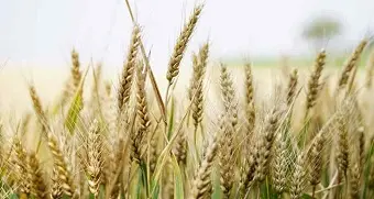
The world is witnessing a renaissance in agriculture through the fusion of technology and traditional farming practices. One of the most transformative technologies shaping modern agriculture is satellite imaging. These technological advancements provide unprecedented insights into the land and enable farmers to optimize yields, conserve resources, and react proactively to potential threats.
Overview of Satellite Imaging
Satellite imaging, also known as remote sensing, involves capturing images of the Earth from space-based platforms. These images can depict various parameters such as the visible spectrum, infrared, and even radar. This data is invaluable in diverse sectors, from urban planning to disaster management. In agriculture, it offers a bird's-eye view of vast stretches of farmland, providing critical insights on several fronts.
Precision Agriculture
Precision agriculture is about optimizing farming practices based on real-time data. Satellite imagery aids this optimization by providing accurate data on soil health, plant health, and moisture content. With this information, farmers can:
- Allocate resources more effectively by targeting specific areas that require attention.
- Make informed decisions regarding irrigation, fertilization, and pesticide application.
- Monitor the progress of crops and predict yields.
Irrigation Management
Water scarcity is a significant global challenge, and efficient water use is critical in agriculture. Satellite images can identify moisture levels in the soil, helping farmers schedule irrigation more effectively and conserve water. This also ensures that crops receive water at their critical growth stages.
Pest and Disease Monitoring
Early detection of pests and diseases can save a substantial portion of a crop yield. Satellite images, particularly when combined with thermal and hyperspectral imaging, can identify areas of stress in crops that might be due to pests or diseases. This early warning system enables farmers to apply remedies proactively and precisely where needed, minimizing losses.
Soil Health and Fertility Mapping
Understanding soil health and fertility is pivotal for successful farming. Satellite images can provide information about soil types, organic matter content, and potential deficiencies. Based on this, farmers can customize their fertilization practices, ensuring that crops receive the right nutrients in the correct amounts.
Crop Forecasting
By monitoring crop growth patterns and other environmental factors, satellite imaging can be used to predict crop yields. These predictions are invaluable for farmers, governments, and commodity traders as they can make informed decisions regarding market prices, storage, and distribution.
Assessing Damage After Natural Calamities
Natural disasters can devastate farmlands. Whether it's floods, droughts, or storms, satellite imagery can swiftly assess the extent of damage, enabling faster response in terms of aid, insurance claims, and recovery measures.
Monitoring Land Use and Crop Rotation Patterns
Satellite imagery provides a long-term view of how land is utilized. This helps in understanding crop rotation patterns, which can benefit soil health and yield. Additionally, it can guide policy-makers in creating sustainable agricultural practices.
Climate Impact Assessment
The implications of climate change on agriculture are profound. Satellite images can track changes in weather patterns, temperature, and rainfall. This data is crucial in understanding the impact of climate change on crops and can guide the introduction of resilient crop varieties.
Final Thoughts
Satellite imaging is revolutionizing the agricultural sector, bridging the gap between traditional practices and the demands of a rapidly changing world. By offering insights that were previously inaccessible or hard to quantify, satellite technology ensures that farming is not only more productive but also sustainable. As the world grapples with challenges such as food security, water scarcity, and climate change, the marriage of satellite imaging and agriculture offers a beacon of hope.
Product Details:
Global Satellite Imaging for Agriculture Market 2023
Published: August 2023
Pages: 87
A full collection of in-demand research studies featuring different sectors of the agriculture market is available in this Market Publishers’ catalogue.
CONTACTS
The Market Publishers, Ltd.
Natalie Aster
Tel: +357 96 030922
Fax: +44 207 900 3970
[email protected]
MarketPublishers.com
Analytics & News
29 Oct 2026
Where Is the Diagnostics Market Heading? 10 Promising Sectors to Watch
26 Oct 2026
Weekly Chemical Market Tracker: Update for October 19-26, 2026
23 Oct 2026
Military Aviation Market: Recent Developments Shaping 2026
21 Oct 2026
New Era of Cryptocurrency: The Rise of Regulated Digital Finance
19 Oct 2026
Weekly Chemical Market Tracker: Update for October 12–19, 2026